New GNAHRGIS Polygon Tool Announced!
In 2020, Georgia HPD received a federal grant to rebuild and enhance Georgia’s Natural, Archaeological, and Historic Resources Geographic Information System (GNAHRGIS). This project was completed this summer, and new tools are available for surveyors completing data entry in the Historic Resources module of GNAHRGIS. The consolidated rebuilt platform now allows users to download results of searches to Excel. Users can also query historic resources by survey attributes, as well as via the map. For example, a user can layer attributes to perform advanced searches, such as how many front gable bungalows in Lowndes County have been recorded in GNAHRGIS. Another new feature is that all of the properties listed in the National Register of Historic Places in Georgia have been added to the database, along with digitized nominations and maps. Currently, there are 127,384 historic resources in GNAHRGIS.
Along with these research tools, GNAHRGIS now includes two new tools aimed at facilitating data entry for surveyors – the windshield district polygon tool and integration of the mobile app, ESRI Field Maps.
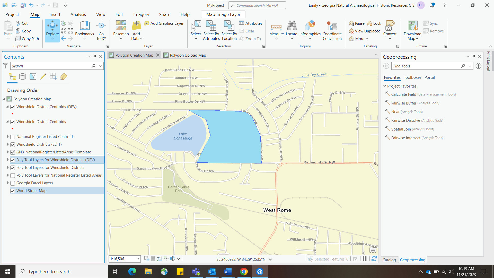
Windshield District Polygon tool
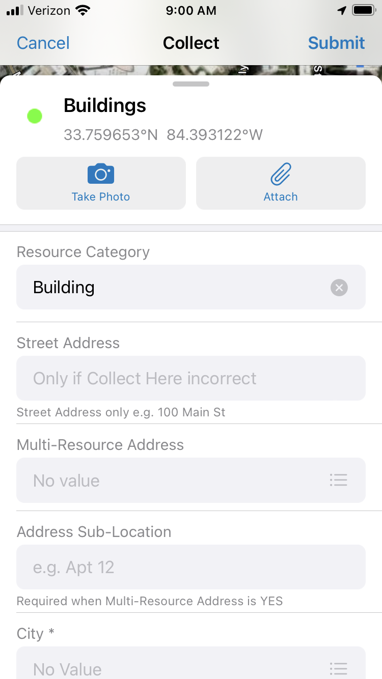
The windshield district polygon tool allows surveyors to record the following attributes for a grouping of physically similar or related, geographically proximate resources: resource category, basic resource information, general characterization, approximate resource count, primary resource types, primary architectural styles, development time period, boundary types, acreage, boundary description, boundary justification, description, history, and field survey evaluation. Surveyors can also attach photographs and other documentation. These records can now have polygon data attached via ArcGIS Online. This tool allows surveyors to represent these resources as polygons in GNAHRGIS, instead of just points. HPD’s Historic Resources Survey Program offers specific guidance and training for using this tool. It can be used to record neighborhoods of similar resources, resources with large acreage, complexes, and resources with multiple buildings.
esri field maps app integration
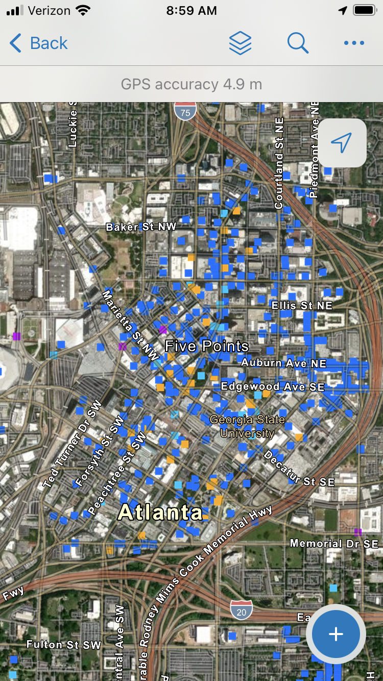
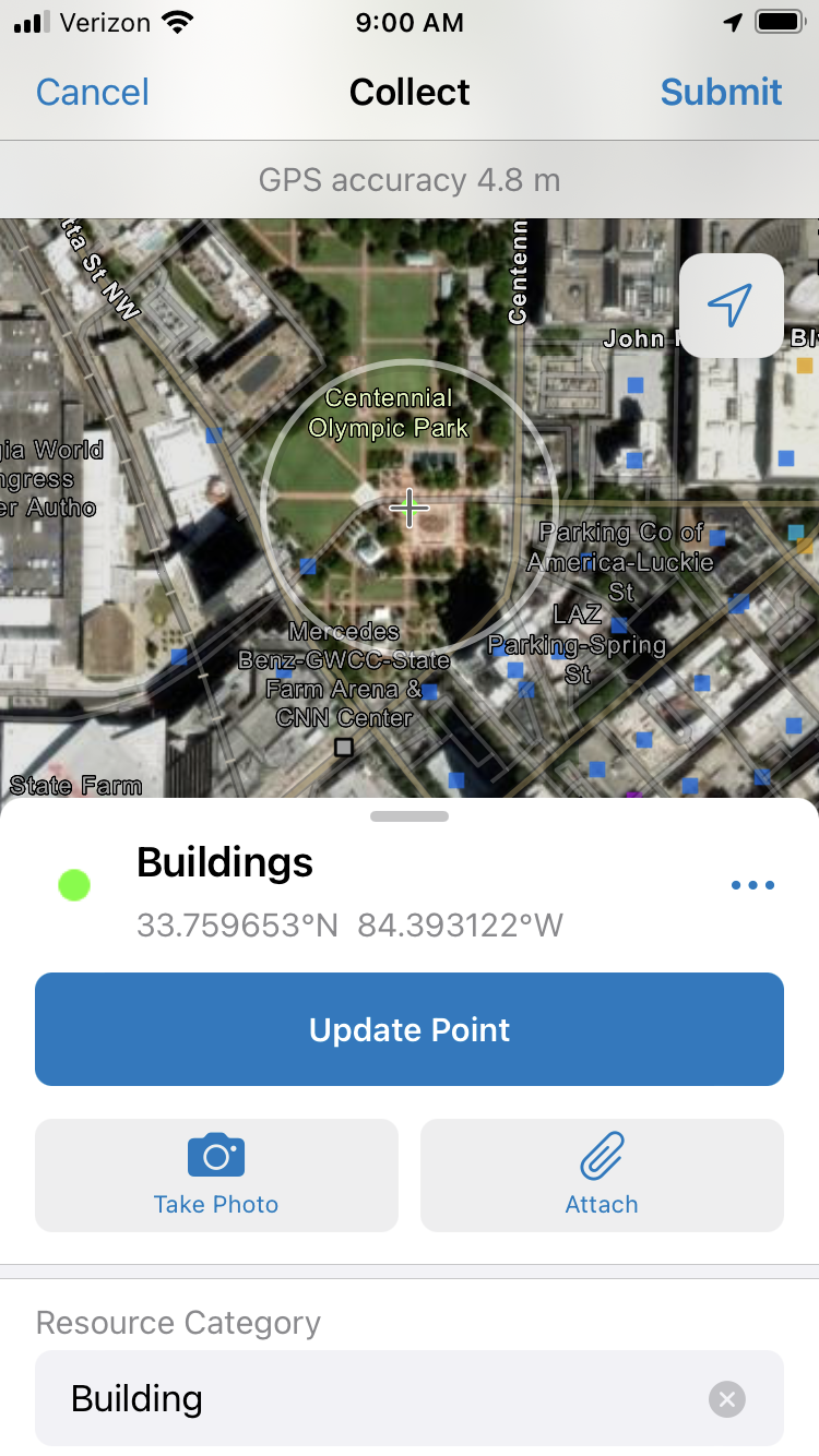
As part of the GNARHGIS rebuild and update, HPD partnered with ITOS of the Carl Vinson Institute of Government at the University of Georgia, Georgia Department of Transportation, Georgia Transmission Corporation, and the National Alliance of Preservation Commissions (NAPC) to integrate the NAPC’s CRSurveyor App to GNARHGIS. The app is designed to help communities survey cultural resources digitally. This solution allows a survey team from a community or organization to take phones or tablets into the field and accurately capture location and specific details about historic sites. The data is saved into a data structure that matches the National Park Service cultural resource standards and catalogs many historic resources survey attributes. This data can be collected offline and ‘synced’ when the surveyor obtains connectivity.
The solution uses the ESRI ArcGIS platform and was designed using Field Maps for ArcGIS. Field data is collected using the ESRI Field Maps Application on a mobile device. The data and maps are stored in the ESRI cloud-based ArcGIS Online platform. Surveyors will access ArcGIS Online through ITOS, so a surveyor does not need an independent ArcGIS license to use the tool.
Field Maps is available for communities to use in CLG surveys, locally funded surveys, and environmental review mitigation surveys if the survey area does not contain any resources that are already in GNAHRGIS; the app does not allow for resurvey of pre-existing resource points. HPD hopes that Field Maps is a useful tool in reducing the amount of time required for historic resources survey data entry, facilitating survey work statewide.
Ready to get started?
If a CLG or community is interested in using Field Maps or the windshield district polygon tool for a forthcoming project, please contact survey@dca.ga.gov to ensure the project is a good fit for the tools. Both the app and the polygon tool should be used by professional consultants or volunteers with required additional training. Field Maps may be used in conjunction with traditional fieldwork and GNAHRGIS entry if clear boundaries are defined for the project for areas previously surveyed. CLGs and communities would be expected to work with HPD staff to clearly define the project in this way.
Additional information on windshield surveys and user guidance for the polygon tool and Field Maps is available on HPD’s website here.
HPD is looking forward to working with communities and surveyors statewide to experiment with these new tools in support of improved historic resources survey in Georgia!